Definition And Purpose
 Hydrographic Survey is to depict not only the relief of the seabed, including all features, natural and man-made, and to indicate the nature of the seabed in a manner similar to the topographical map of land areas but also to record data on tidal phenomena such as tidal regime, current, wave, salinity, wind etc as required by the client.
Methodology and Instrumentation
Methodology and Instrumentation depend on whether it is coastal bathymetry, inshore or offshore hydrographic survey. However, in general the nautical charting role of hydrographic surveying consists primarily of water depth measurements, reduced to a datum plane at known positions on the sea surface. Additionally, information on the sea bed type, water movements and wave may be sought. Apart from the basic techniques as in navigation and positioning and geodesy, there are now many other techniques available. In general, a hydrographic survey project will include all or a majority of the following tasks:-
-
Preparation and mobilization of personnel and equipment
-
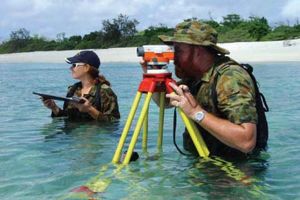
Shore Control Surveys
-
Establishment of Tide Gauges, Tidal Observation and Analysis
-
Preparation and Calibration of Electronic Systems in the working area
-
Field Campaign (the detail tasks will depend on the activities being carried out)
-
Data processing and charting
-
Demobilization of personnel and equipment
-
Compilation of survey report
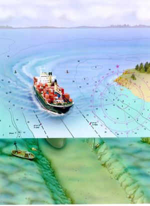 Water depth measurement using lead lines and sextant has now been replaced by modern electronic instrumentation such as echo sounders, side scan sonar sweeping systems and electronic positioning systems even though a basic principle remains. The major instrumentation for hydrographic survey are:-
-
Position fixing equipment
-
Echo sounders and
-
Tide gauges