Cadastral/Land
Cadastral Survey / Land Title Survey is a survey carried out to produce a cadastral plan. A cadastral plan may be defined as a map or plan which identifies a particular parcel of land for purposes of ownership and registration ..Read more

Deformation/Monitoring
Deformation Monitoring is a Land Survey activity during which repeated observations are made within a specified time frame for the purpose of detecting and quantifying movements of natural or man-made structures..Read more

Engineering
Obtaining ground data spatially referenced to boundary and survey reference marks to support engineering designs of civil works (roads, railways, water-ways, buildings etc.) ..Read more

Geodetic
Geodetic surveying is defined as the determination of positions on the earth's surface with reference to an ellipsoid...Read more

Hydrographic
Hydrographic Survey is to depict not only the relief of the seabed, including all features, natural and man-made, and to indicate the nature of the seabed in a manner similar to the topographical map of land areas..Read more
Strata Title
Strata Title Survey is a survey carried out for the sub-division of any building/buildings, having two or more storey on alienated land held as one lot under Final Title into parcels each to be held under a separate Strata Title..Read more

Topographical Mapping
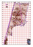
Topographical Mapping involved the survey of position and shape of natural and artificial features on the earth. These are then presented either in analogue (hard copy) or digital form. Topographical plan/map is used for design and planning purposes..Read more
Land Matter in Land Development
Land development requires a complex process of many interrelated parts or land development is both an art and sciences, the most important aspect is its holistic nature.. ..Read more
Land Information’s and Development Planning Requirement Search
Some of the basic information’s shall acquired before any land dealing or transaction and any land development took place. ..Read more